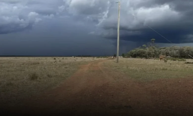
Heavy rain has started falling across parts of northern Queensland, with authorities warning that flash flooding could develop and persist into next week.
Severe thunderstorm warnings were issued on Saturday afternoon for areas along the state’s north tropical coast, including Townsville. The Bureau of Meteorology (BOM) said isolated locations in the north-west were at particular risk, with forecast daily rainfall totals potentially exceeding 200 millimetres over the coming days.
Senior forecaster Felim Hanniffy said widespread showers and storm activity were expected across the northern half of the state on Saturday. Severe storms could affect regions stretching from the north-east tropical coast through to the north-west and Gulf Country.
The BOM also warned of localised intense rainfall in parts of the far north-west, the Gulf, and along the north-east tropical coast. Rainfall is forecast to intensify and continue over several days in the north-west and Gulf regions, with Sunday totals likely to range between 100 and 200mm.
“In some isolated areas, rainfall could exceed 200mm on a daily basis,” Mr Hanniffy said.
Flood watches are already in place across much of northern Queensland following an exceptionally wet week. Seven-day rainfall totals in some areas have already topped 200mm due to persistent showers and storms.
With catchments already saturated, the BOM has warned of a possible prolonged flood event in parts of the north-west extending into next week.
‘Business as usual’ in Mount Isa
In Mount Isa, residents are preparing for significant rainfall and cooler temperatures, which could be more than 12 degrees Celsius below average, according to BOM forecasts.
Mayor Peta MacRae said on Saturday morning that rainfall had so far been light, but heavier falls were expected from Sunday and into next week.
“Everyone in Mount Isa is watching and waiting to see what happens,” she said. “Our community is well prepared. This is cyclical for us. We’ve been cut off before, and we’re expecting to be cut off for a short period of time.”
For now, Cr MacRae said it was “business as usual,” with locals enjoying the cooler conditions while keeping a close eye on the situation. Her main concern was ensuring essential supplies remained available in town.
Mount Isa District Acting Superintendent Paul Austin echoed the need for caution, noting that while residents are familiar with wet-season conditions, the predicted rainfall was significant.
“We’re receiving advice from the BOM of daily falls between 100 and 200mm, and in some isolated areas up to 300mm per day,” he said.
He also warned graziers and property managers to prepare for a potential drop in temperatures.
“Easterly winds will bring a fresh change, and there is a risk of cold stress to livestock, similar to what we’ve seen in past weather events,” he said.
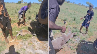
Cr MacRae said farmers were taking precautions and were hopeful the situation would not mirror the devastating floods of 2019, when hundreds of thousands of cattle were lost.
“The cattle are in good condition and stock numbers are a bit lower,” she said. “We’re not expecting the same outcome—well, we’re certainly hoping we don’t.”
In nearby Cloncurry, about 120 kilometres east of Mount Isa, the State Emergency Service began distributing sandbags on Friday. The town recorded 120mm of rain in the 24 hours to 9am on Boxing Day.